
Sponsors are vital for the Dirt Dashes. I like to keep the events at the size they are, and that’s only possible with good support. But sponsors also need to match the event, and I would never recommend a product I don’t believe in.
That’s why it’s great to have komoot as a sponsor of the events. I use the app almost every day for my own adventures. And komoot also is my first choice for planning routes professionally for destinations, books and events.
In this blog I want to tell you a little more about the komoot features I particularly like. Hopefully they’ll be helpful when you’re planning your own trips.
Check out our own Komoot profile
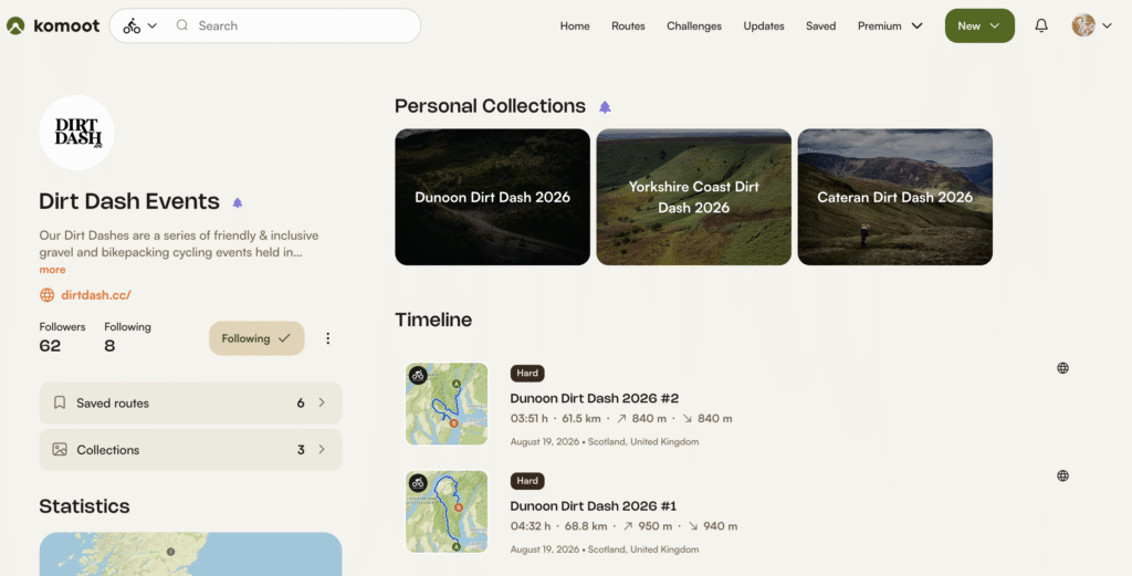
On our Komoot profile you can find this year’s routes for all Dirt Dashes. This will provide you with all the information you need before signing up. Or to ride the routes yourself if you can’t make it to the event. We change the routes every year, so if you join us, there’ll still be something new to explore.
Different Map Layers & Heatmaps
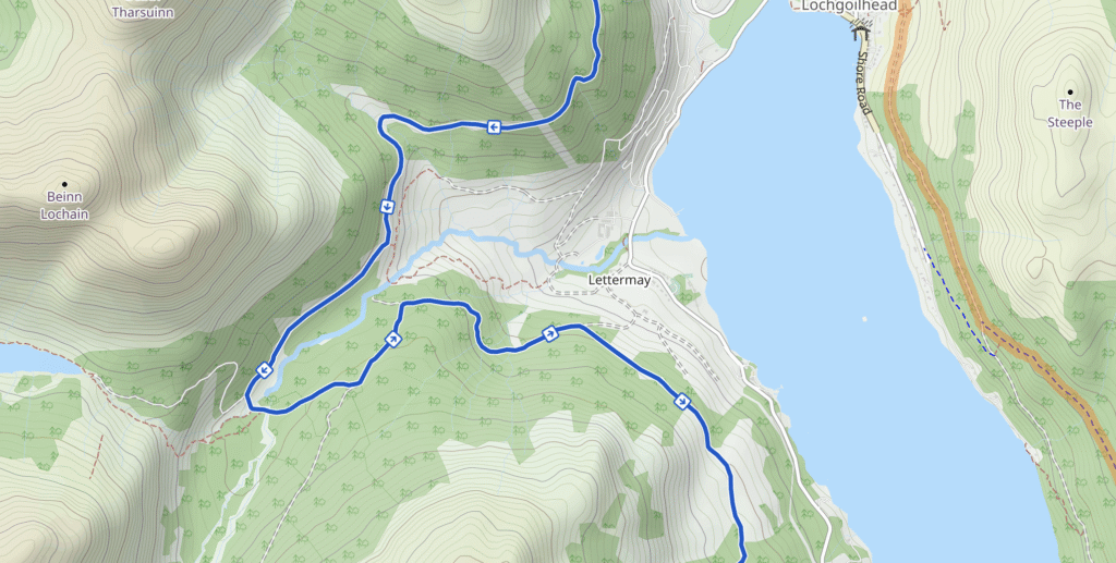
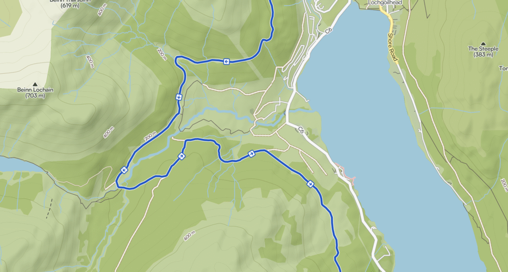
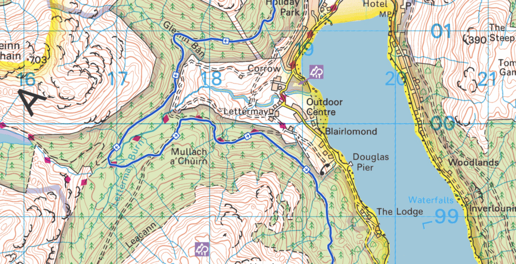
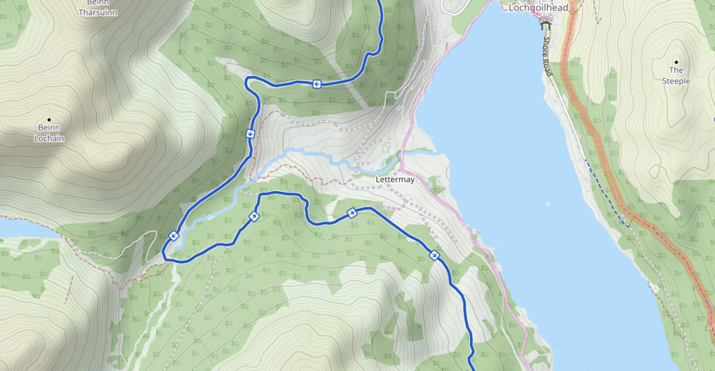
On komoot you can switch between different map styles depending on what you’re looking for. This is a very useful feature when checking trails or the wider landscape. Ordnance Survey,Swisstopo, USGS, IGN Spain and other official topographic maps are now available to Premium users. Komoot and Open Cycle Map layers also help you to plan more precise routes with topographical map shading.
Not sure if you have ridden a trail a few times? Or if something is suitable for a gravel or more a mountain bike? You can use personal and global heatmaps, available for individual activities, as a guide. Light pink is an indication that people have cycled there before. And deep pink means you are likely to see other riders out there.
3D Maps
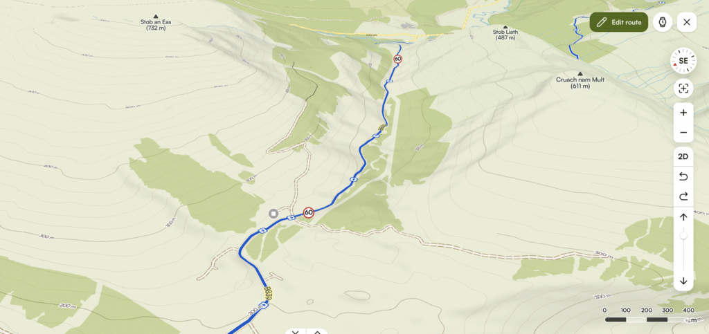
This feature gives you a much better idea of the terrain when planning a route then just a simple map. The picture above visualises Hell’s Glen on the Dunoon Dirt Dash route.
Individualised Waypoints
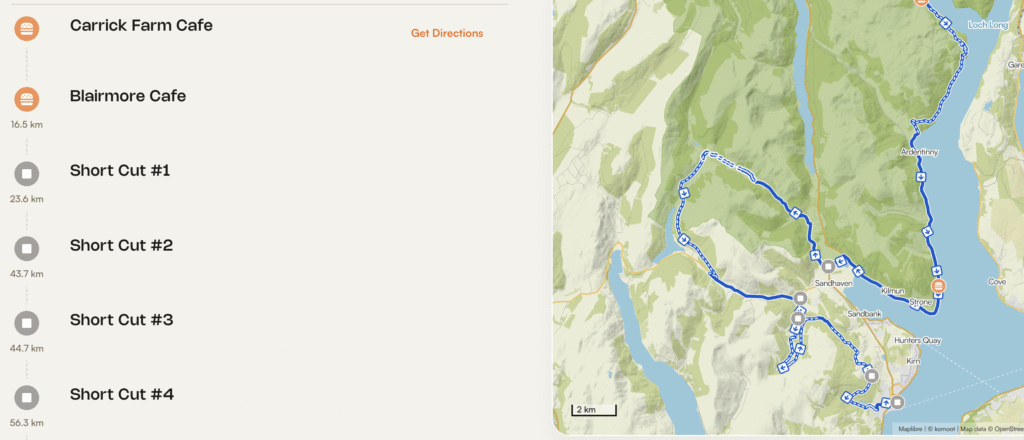
This is a feature to remind yourself of important stops along the route, and to name the start and finish. This is available in the free version of the app.
See What’s Underneath The Blue Line
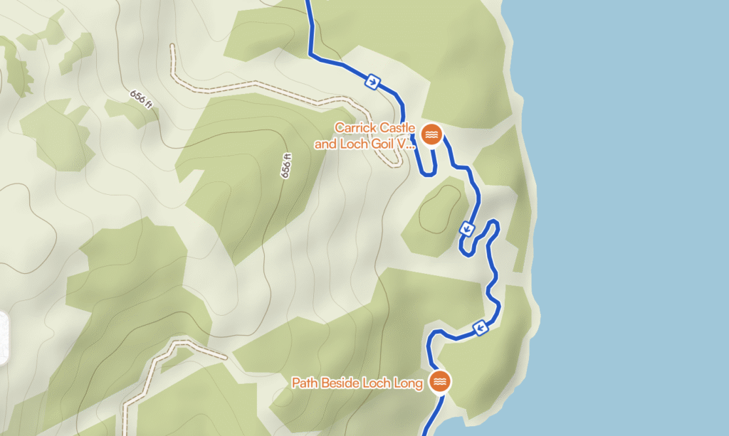
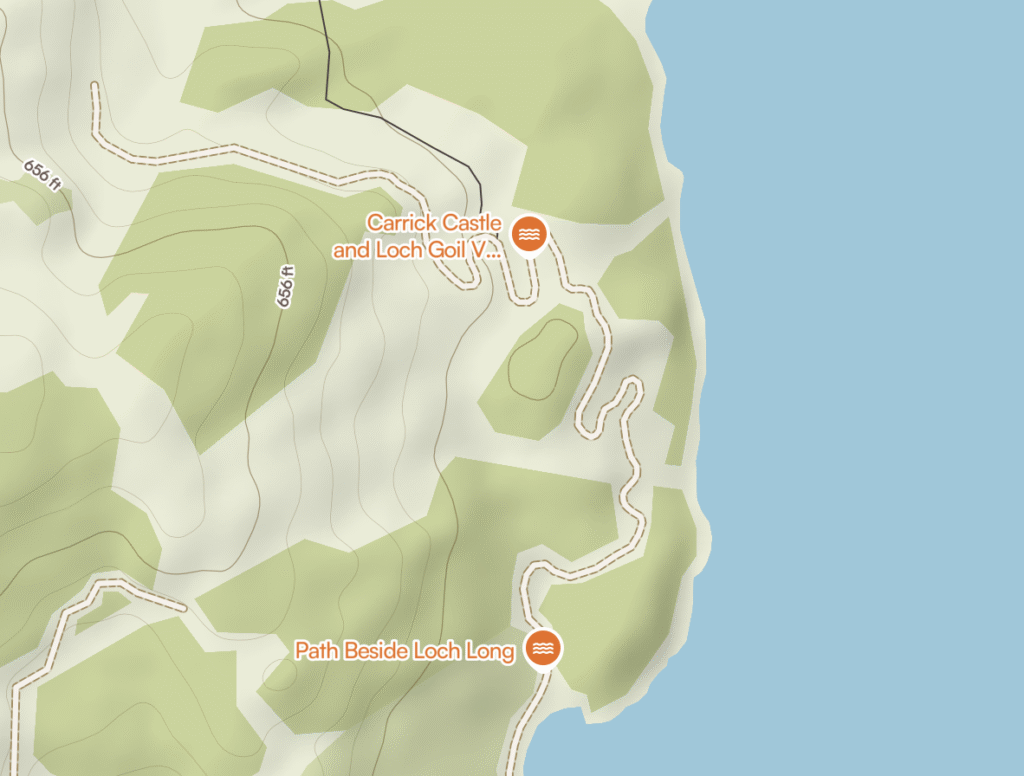
For planning routes for my books, this is the most important feature. Pressing M on the desktop makes the blue line dissappear, and I can double check the path underneath. For gravel riding I much prefer double tracks to singletrails, and this feature helps making a good route better. The same feature is available on the mobile app by pressing the eye icon.
Offline Feature & Download GPX
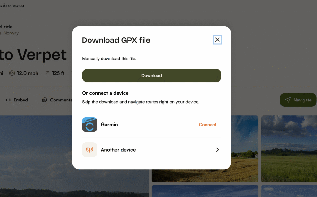
Komoot’s offline feature lets you download maps and planned routes to your phone or smart watch. Navigate without data service, save mobile data, and preserve battery life. You can also download the route as GPX and use your GPS device, or sync it. You get your first region pack free. Or unlock more via single regions, region bundles, or the World Pack. Or get Premium where all features are included.
Discover routes
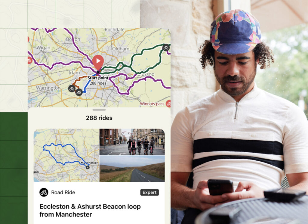
The Komoot Discover feature lets you find community-tested routes, local highlights and expert collections. Either for hiking, cycling or running anywhere in the world. You can filter recommendations by sport type, distance, duration, elevation, and starting location (like a train station or ferry terminal).